Home
Call for papers
Programme
Important deadlines
Authors instructions
Keynote speakers
Technical exhibition
IPIN grant programme
Registration
Programme committee
Local organizing committee
Tourism info
Conference venue
Travel info
Accommodation
Bid for IPIN'2012
Contact
Photos
Best paper & poster
Other IPIN conferences
IPIN'2010
IPIN'2012
IPIN'2013
IPIN'2014
|
Collaborative Positioning and Navigation
21-23 Sept. 2011
Keynote speakers
|
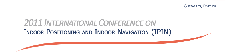
Dr. Rainer Mautz, ETH Zurich, Switzerland
|
Biography:
Dr. Rainer Mautz is Senior Research Assistant at the Institute of Geodesy and Photogrammetry at the ETH Zurich in Switzerland. As a Lecturer and Researcher in Geodetic Metrology and Engineering Geodesy he has been actively carrying out research in his fields of Geodesy and Indoor Positioning. He holds a PhD degree in Geodesy from the Technical University Berlin, where he spent four years at the Institute of Geodesy and Geoinformation getting extensive expertise in geodetic research in combination with teaching practical courses in geodetic studies. In his thesis, he solved the mathematically challenging optimization problem of finding the true frequencies in time series. In 2002 he was awarded the prestigious Feodor-Lynen fellowship of the Alexander von Humboldt Foundation for research in Geodetic Science at the Ohio State University, USA. As a Lynen-Fellow he joined the Laboratory of Space Geodesy and Remote Sensing Research and participated in international as well as interdisciplinary research projects focusing on gravity, sea surface and ionospheric modeling based on CHAMP, GPS and altimeter satellite data. Between 2004 and 2006 he was with Imperial College London as a researcher on an project focusing on wireless sensor networks, network positioning technology, network adjustment, error propagation and integrated navigation systems. In the past 12 years since he began his academic career, Dr Rainer Mautz has contributed to state-of-the-art research in a wide spectrum of science within the field of Engineering Geodesy and Indoor Positioning.
Keynote Title: Overview of Indoor Positioning Technologies
Abstract:
Providers, researchers and developers of indoor positioning systems are doubtlessly experts in the techniques that their approach involves. However, the full spectrum of existing alternative approaches to the indoor positioning challenge is oftentimes not well known. In a similar way, users looking for a solution in their application field are struggling to get an overall picture on todays possibilities. This talk outlines the different general technologies that have recently been implemented or proposed. Each technology is briefly described and characterized in terms of performance parameters, strengths and drawbacks.
Presentation:
Rainer Mautz presentation is available here.
|
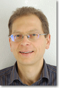
Dr. Mike Hazas, Lancaster University, UK
|
Biography:
Mike Hazas is a lecturer in the School of Computing and Communications at Lancaster University, UK. Mike received his PhD degree from the University of Cambridge (2003) for his work on broadband ultrasonic location systems. Since then, Mike has worked on position and context sensing hardware and signal processing, with a focus on evaluation using real deployments. More recently, Mike has also been interested in applying his research background in pervasive sensing and algorithms to develop more nuanced understandings of how personal and domestic practices are connected to the energy that supports them.
Mike has been involved with the technical and organising committees for conferences in both pervasive computing and sensor networks for a number of years.
Keynote Title: Indoor Acoustic Localisation: New Developments
Abstract:
This talk discusses the state-of-the-art in location sensing and tracking for two different types of acoustic signal: (1) audible sounds which occur due to people's movement indoors; and (2) broadband ultrasonic signals which can be used for very robust and accurate tracking. Discussing each type in turn, I will cover considerations for an end-to-end system: transducers and sensing hardware; the indoor acoustic channel; signal processing and algorithms; and calibration.
Localisation performance will be discussed for both types, based on measurements from deployed research hardware.
Presentation:
Mike Hazas presentation is available here.
|
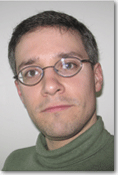
Dr. Knut Siercks, Hexagon Technology Center GmbH, Heerbrugg
|
Biography:
Dr. Knut Siercks is since 2004 responsible for the central R&D of Leica Geosystems AG. After studying electrical engineering and acquiring a Ph.D. in the field of laser distance measurement and 3D object measurement Knut Siercks has led the working group for optical measurement technology at the faculty of electrical engineering and information technology at Ruhruniversität Bochum. His industrial activities begin at Gesellschaft für Lasermesstechnik with the development of a 3D measurement system for the production process of power plant turbines at Siemens KWU. Afterwards he took over the strategic development of core technologies and IP management at Leica Geosystems AG. In parallel, Knut Siercks has built up the central research and development organization of the company which he is heading since 2004. After the merging of Leica Geosystems with Hexagon AB in 2005 Knut Siercks became the director of the new central R&D organization and of technology development in the Hexagon group.
Keynote Title: Hexagon: Space for Innovation in Space
Abstract:
As the number of different approaches for indoor positioning shows, it is unlikely that this problem will be solved with a single technology, but rather that a combination of complementary measurement technologies will be used. Also the transition between indoor and outdoor positioning will be a point where different technologies are going to mix and overlap. Such combinations of sensors and technologies ask for a holistic innovation process with a focus not only on the optimization of single components but on the integration of the overall measurement process. Hexagon is because of its structure and its diverse offering of technologies prepared to tackle these kinds of all-embracing development tasks from sensors via software up to the integration into CAD and GIS systems in a successful way.
To demonstrate this, selected components of the innovation process, current success factors and their combination with the central management of core technologies will be presented. The result of this innovation process the technologies of selected products will be introduced: the products of Leica Geosystems measure millimeters over distances of some kilometers: Hexagon Metrologys products measure micrometers over the distances of meters. By using a central technology management, synergies between these subsidiary companies can be realized in the context of a growing global technology company which develops and markets its products internationally. This will be shown on selected technology examples.
Presentation:
Dr. Knut Siercks presentation is available here.
|
Organized by

in Partnership with


Supporters


|